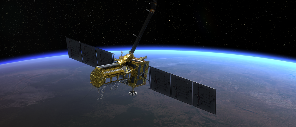
Mission Overview
The NISAR satellite will orbit Earth for at least three years, using its sophisticated radar systems to scan nearly all the planet’s land and ice surfaces twice every 12 days. NASA and the Indian Space Research Organisation (ISRO) will jointly operate the spacecraft and gather science of high priority to both the U.S. and India. Mission data will be of interest not only to scientists, but also to farming communities and people affected by earthquakes, deforestation, volcanic eruptions, land subsidence, and sea level rise. The data will inform society’s responses to urgent challenges posed by natural disasters and environmental changes. It will also support monitoring of infrastructure such as dams, bridges, and roadways.
Launch
ISRO is responsible for preparing the NISAR satellite for launch and for launching the satellite into orbit. NASA’s Launch Services Program, based at Kennedy Space Center, is providing supplemental support on technical aspects of the launch.
Launch Site and Vehicle
The NISAR satellite will launch aboard an ISRO Geosynchronous Satellite Launch Vehicle. The three-stage vehicle is about 170 feet (52 meters) tall with a payload fairing 13 feet (4-meters) in diameter. The rocket will lift off from Satish Dhawan Space Centre, Sriharikota, on the southeastern coast of India.
For more information on the launch site, visit shar.gov.in.
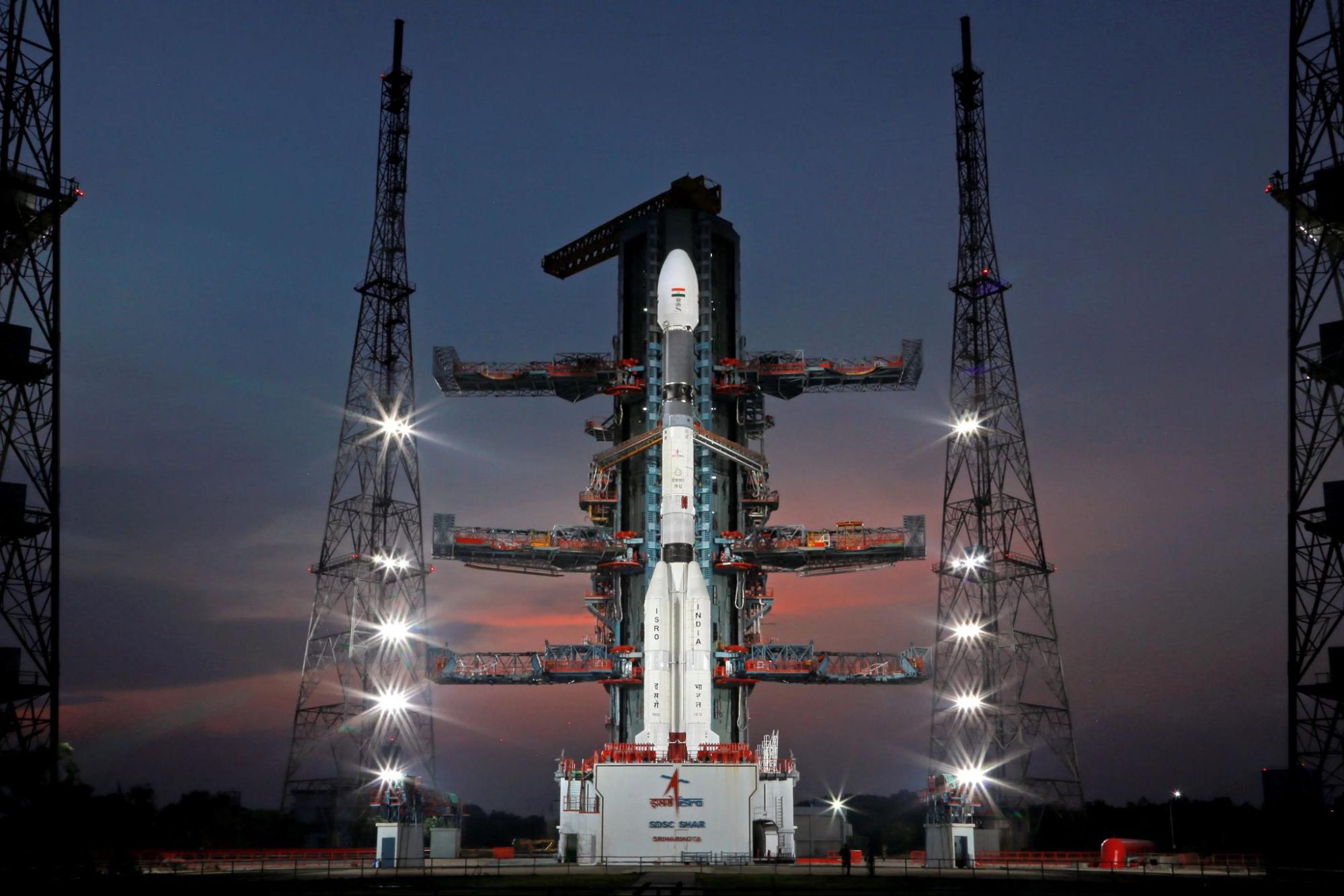
A GSLV rocket prepared for launch at ISRO's Satish Dhawan Space Centre. Credit: ISRO / Full Image
Launch Date and Timing
The exact launch date of NISAR will be determined by ISRO and announced closer to launch. Updates from ISRO will be available at isro.gov.in and x.com/isro; NASA updates on NISAR’s road to launch are available at science.nasa.gov/blogs/nisar.
The launch window opens at 5:40 p.m. IST (12:10 p.m. UTC or 8:10 a.m. EDT) and is 10 minutes long. Both the launch time and the launch window will remain the same for subsequent days.
Key Events After Launch
The specific launch events, including separation of stages and satellite, will be updated on the ISRO website closer to the launch date. For more information, visit: isro.gov.in/NISARSatellite.html.
Commissioning Phase
After launch, the mission team will begin a commissioning phase that is expected to last about 90 days. During this period, they will check out spacecraft systems and deploy the boom and giant radar antenna reflector. The performance of the radar instruments will also be assessed against specifications.
Science Operations
Science operations begin after completion of the commissioning phase. Calibration and validation activities, in which teams ensure the satellite’s science instruments are collecting data properly, occur during the first five months of science operations.
The NISAR satellite will operate in a Sun-synchronous orbit with an inclination of 98.4 degrees, covering Earth’s Northern and Southern hemispheres. In this type of polar orbit, the spacecraft maintains a fixed orbit orientation with respect to the Sun: It will visit the same spot on Earth at the same local time twice every 12 days. This regularity will enable scientists to compare how particular regions change over time.
The spacecraft will orbit at an altitude of 464 miles (747 kilometers), circling Earth about 14 times per day. NISAR will cover nearly all our planet’s land and ice surfaces, and the instruments will be pointed so that they provide unprecedented coverage of the Southern Hemisphere. With a prime mission of three years, NISAR will downlink about 35 terabits of unprocessed L-band data and 4 to 6 terabits of S-band data per day.
Download the Press Kit