
As of July 20, the public can access data from the two powerful radar instruments aboard the NISAR (NASA-ISRO Synthetic Aperture Radar) satellite. Teams in the United States and India will release files processed from the satellite’s L-band and S-band radars on an ongoing basis, helping researchers and other users track the movement of Earth’s land and ice masses, monitor changes in ecosystems like forests and wetlands, and respond to natural hazards such as landslides and earthquakes.
The release comes as NASA and ISRO (Indian Space Research Organisation) prepare to celebrate the first anniversary of NISAR’s July 30, 2025, launch from India’s Satish Dhawan Space Centre. Since that time, the mission engineering and science teams have been busy calibrating instrumentation, refining algorithms, and monitoring nearly all the planet’s land- and ice-covered surfaces twice every 12 days. Along the way, the team has captured scenes from around the globe — urban street grids, agricultural fields, landslides, earthquakes, and sinking land in Mexico City.
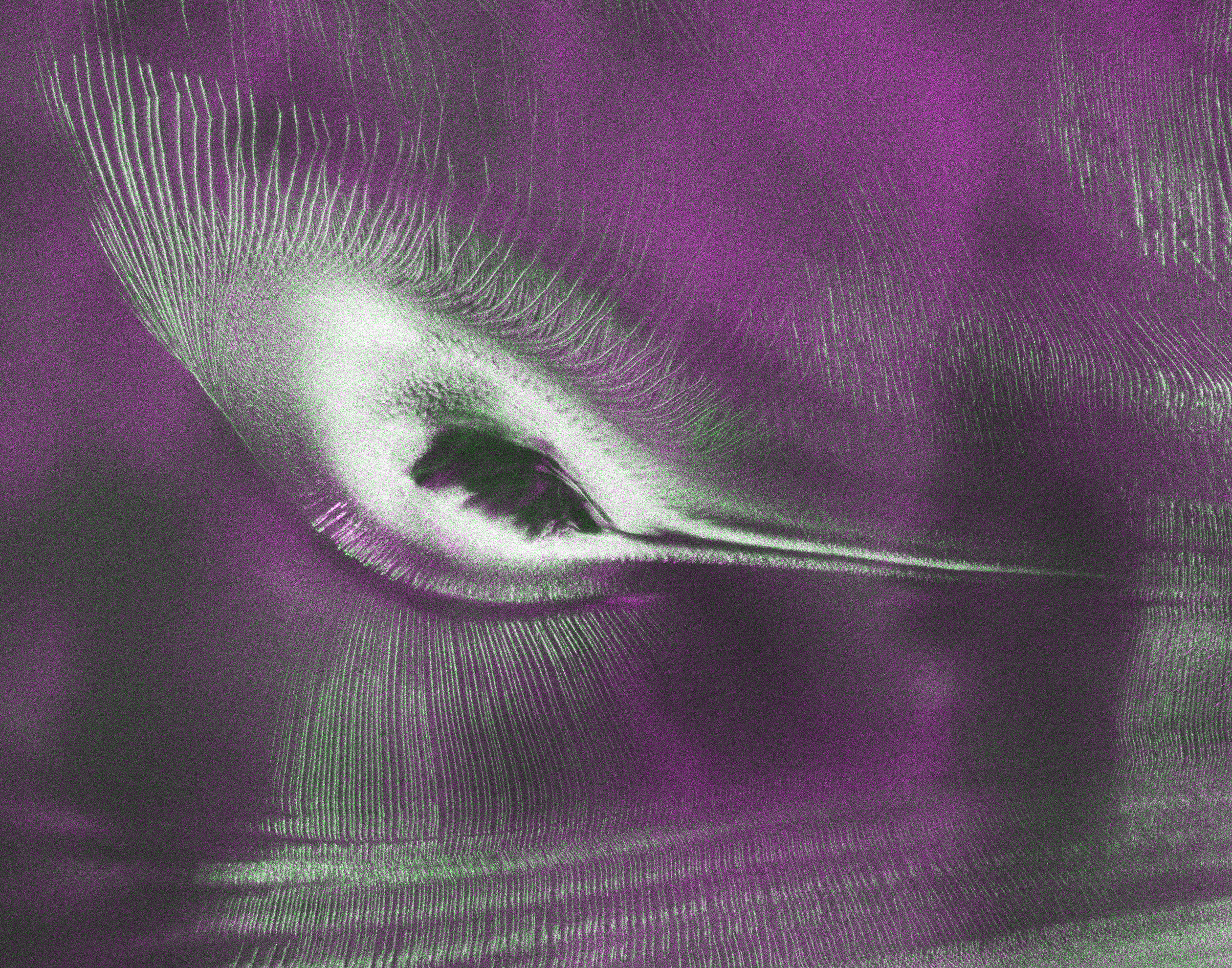
An early image released Tuesday revealed the fractured, barren surface of an Antarctic landscape in stark detail. In a merging of science and serendipity, it also resembles something else entirely: a hummingbird.
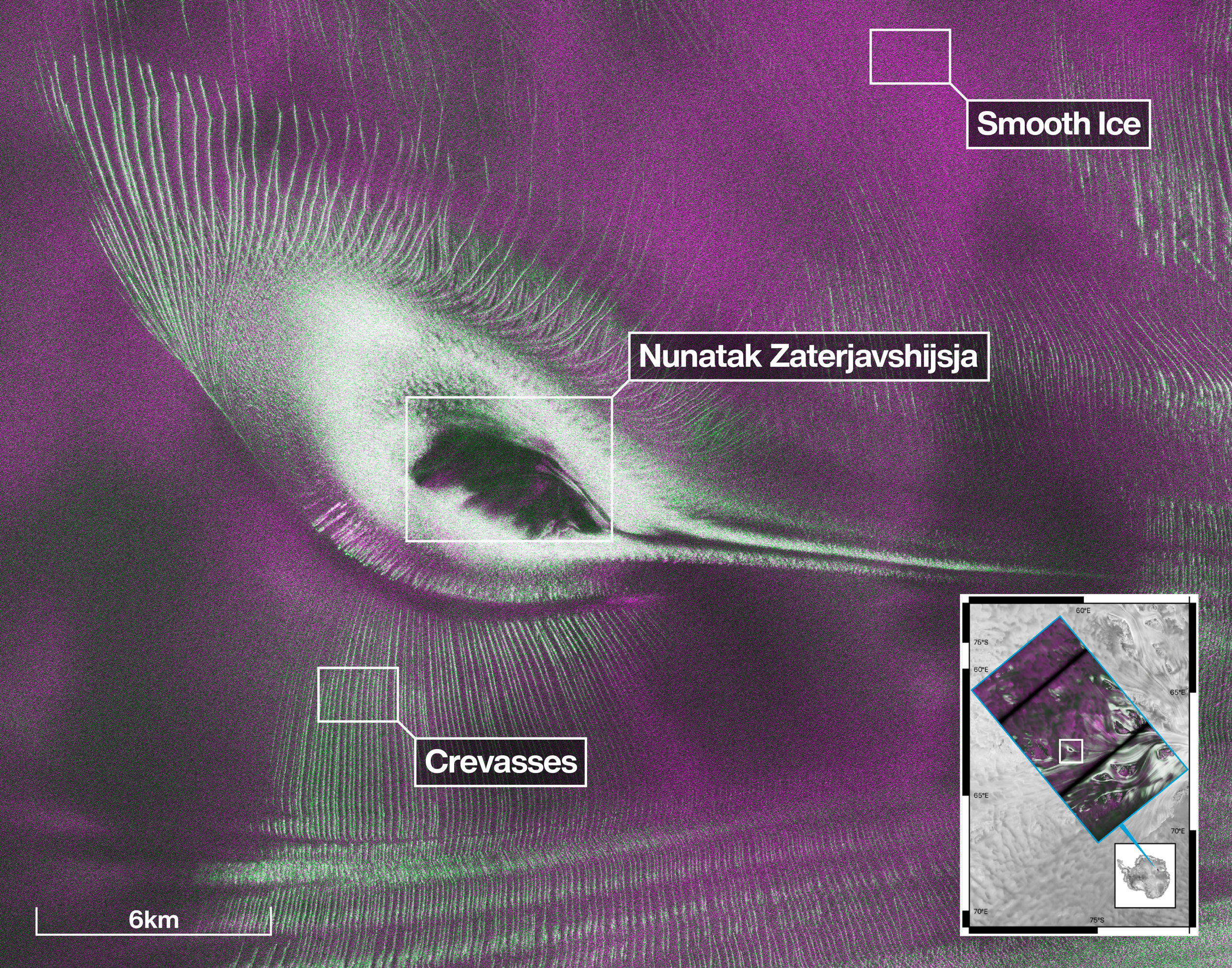
Despite its otherworldly quality, the Antarctic image shows a very real geographical feature called Nunatak Zaterjavshijsja, a mountaintop in East Antarctica, poking out amid a stream of ice flowing northeast to the ocean. As the moving glacier passes the obstruction, the mountain’s topography causes stresses in the ice, heavily fracturing the surrounding surfaces with deep cracks, called crevasses, which show as sharp green lines in the image.
“First, it’s a beautiful image, with rich details of features that provide insights to how the glacier is moving. Then, because radar can often see through snow and deep into the ice, NISAR can observe fundamentally different properties of Antarctic ice than can be seen in optical imagery,” said Seongsu Jeong, the signal analysis engineer who produced the image at NASA’s Jet Propulsion Laboratory in Southern California. “With NISAR we’re seeing what’s hidden beneath the surface.”
Story in magenta, green
Generated with measurements that NISAR’s L-band instrument gathered in August 2025, as U.S. and Indian mission teams tested the satellite’s systems, the “hummingbird” exemplifies one of the young mission’s hallmarks: intricately detailed imagery that is both informative and eye-catching.
The colors show differences in the way polarized microwave signals, which vibrate in different directions, interact with and reflect from the ice. Over Antarctica, NISAR transmits radar waves toward Earth with a horizontal polarization. The orientation of the signals that return — either horizontal, vertical, or both — provide clues about the object or surface that reflected them.
Signals that come back with a horizontal polarization likely bounced off a more regular surface, such as smooth ice. Those signals appear magenta in the image. Signals that return with vertical polarization may have refracted as they partially penetrated the snow and ice or scattered at different angles as they reflected off irregular surfaces, such as the faces of crevasses. Called volume scattering, these observations are displayed in green.
The white represents areas in which magenta and green signals scatter back strongly, a possible indication that there is an equal blend of surface and volume scattering.
The same scene viewed in optical light is almost entirely white with ice and snow. Slight shadows and rippling indicate the presence of the mountaintop, and textures in the surrounding area suggest the ice is not completely smooth.
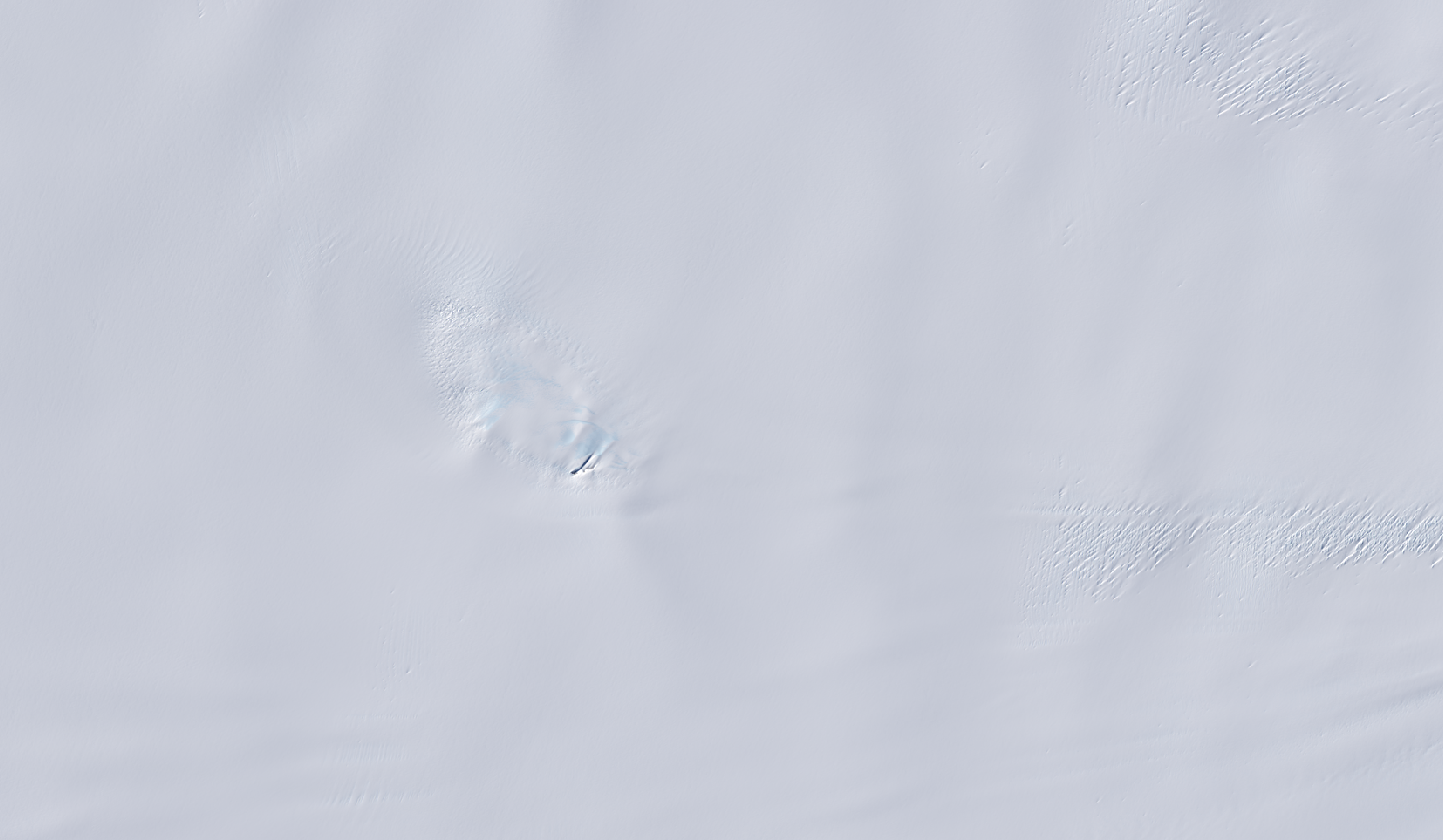
An image from the Landsat 9 satellite shows Nunatak Zaterjavshijsja on Nov. 2, 2025. Because microwaves can penetrate frozen surfaces, signals from NISAR’s L-band radar captured more detail of the structure of the surrounding icescape than is visible in this optical image.
Access to data
The NISAR satellite is the first free-flying space mission to feature two radar instruments: an L-band system and an S-band system. The systems are complementary due to their differing wavelengths. For example, the longer-wave L-band can pass through tree canopies, imaging the ground beneath. Meanwhile, depending on leaf sizes, S-band can collect observations of those canopies.
The Indian science team, based at ISRO’s Space Applications Centre in Ahmedabad, recently started releasing S-band data via the Bhoonidhi portal.
On July 20, the U.S. side of the mission started releasing calibrated products continuously for all L-band measurements collected since June 17. By the end of the year, the team expects to have released all data acquired earlier during science operations. The NISAR project science team previously had two limited releases of L-band data, the first in January of about 25 sample products and a release in February of thousands of pre-calibrated products.
As with the earlier releases, data users will be able to download the latest files at the Alaska Satellite Facility Distributed Active Archive Center in Fairbanks, which hosts and distributes all NASA synthetic aperture radar data.
The NISAR mission’s science data output is vast, on the order of dozens of terabytes a day, due to the satellite’s frequent coverage of nearly all the land and ice surfaces on Earth. It scans from within a few degrees of the South Pole in Antarctica to 77.5 degrees north latitude, above the Arctic Circle.
Get the JPL Newsletter
From Mars to the Milky Way—never miss a discovery! Delivered straight to your inbox.
More about NISAR
Managed by Caltech, JPL leads the U.S. component of the project and provided the satellite’s L-band SAR and antenna reflector. The spacecraft bus and its S-band SAR were provided by ISRO.
The NISAR satellite is the first to carry two SAR instruments at different wavelengths, collecting data using the spacecraft’s giant drum-shaped reflector, which measures 39 feet (12 meters) wide — the largest radar antenna reflector NASA has sent into space.
To learn more about NISAR, visit: