JPL
Careers
Education
Science & Technology
JPL Logo
JPL Logo
Image

The Cydonia "D&M Pyramid" Landform
Sept. 17, 2003
Context Image
Larger image for PIA04745
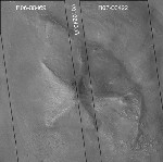
This image from NASA's Mars Global Surveyor highlights a Cydonia landform popularly known as the 'D&M Pyramid' on Mars. Much of the landform is covered with eroded mantling material.
Context Image
Larger image for PIA04745


Images of the Cydonia region of Mars continue to be popular among visitors to the Mars Global Surveyor (MGS) Mars Orbiter Camera (MOC) web site. The two pictures (one annotated, the other not) are mosaics of two images from MGS MOC and one from the Mars Odyssey Thermal Emission Imaging System visible camera (THEMIS VIS). The mosaics highlight a Cydonia landform popularly known as the "D&M Pyramid." It is located near 40.7°N, 9.6°W.

Although it is not really shaped like a pyramid, the Cydonia landform is one of thousands of massifs, buttes, mesas, knobs, and blocks that mark the transition from the far northwestern Arabia Terra cratered highlands down to the northeastern Acidalia Planitia lowlands. Each block, whether shaped like a face, a pyramid, or simply a mesa, massif, or knob, is a remnant of the bedrock of northeastern Arabia that was left behind as erosion slowly degraded the terrain along this zone between the highlands and the lowlands. A few outcroppings of layers in this ancient bedrock can be seen in the mosaic of the pyramid-like landform shown here; much of the landform is covered with eroded mantling material that was deposited long after this highlands remnant became an isolated feature in Cydonia.

The mosaic was created from two MOC images obtained in June (R06-00469) and July (R07-00422) of 2003 and one THEMIS VIS image acquired in 2002 (V01024003). The mosaic is 8 km by 8 km (5 mi by 5 mi) across and each of the three images is illuminated from the lower left. North is up. The picture on the right shows the location of the two MOC images as black outlines; the THEMIS image not only covers the gap between the two MOC images, it also fills out the lower left and upper right corners.

In recent weeks, the MOC team has received numerous requests through the Mars Orbiter Camera Target Request Site to obtain pictures of the "D&M Pyramid." The images shown here were acquired before the public target suggestion effort began in August 2003, but they have not yet been archived with the NASA Planetary Data System. In the future, the MOC team hopes--depending upon whether the spacecraft flies over this area again before the end of the mission--to fill the remaining gap and obtain some 1.5 m/pixel images of the landform, based on the many public suggestions that have been received.

Other, previous MOC data and captioned releases regarding Cydonia landforms can be seen by visiting http://www.msss.com/mars_images/moc/themes/CYDONIA.html and the MOC Gallery.

Download JPG
Download TIFF
Mission
Target
  • Mars
Spacecraft
  • Mars Global Surveyor Orbiter
Instrument
  • Mars Orbiter Camera (MOC)
Credit
NASA/JPL/Malin Space Science Systems

Keep Exploring

A Water Ice Map for Mars

Jezero Crater's Ancient Lakeshore

Growth and Retreat of the CO2 Ice at the Martian Poles

Hydrologic Modeling of Relatively Recent Martian Streams and Lake

Landscape of Former Lakes and Streams on Northern Mars

Using Gravity and Topography to Map Mars' Crustal Thickness

Newly Detailed Map of Mars' Crustal Thickness

Locations of Ice-Exposing Fresh Craters on Mars

Maps of Recurrent Slope Linea Markings on Mars

NASA's Mars Landing Sites, including InSight

Related Topics

QUIZZES .

Space Trivia

News .

NASA’s 6-Pack of Mini-Satellites Ready for Their Moment in the Sun

News .

NASA Orbiter Snaps Stunning Views of Mars Horizon

News .

NASA Uses Two Worlds to Test Future Mars Helicopter Designs

News .

Time Is Running Out to Add Your Name to NASA’s Europa Clipper

News .

NASA’s Mars Fleet Will Still Conduct Science While Lying Low

Robot .

EELS (Exobiology Extant Life Surveyor)

News .

NASA’s Juno Finds Jupiter’s Winds Penetrate in Cylindrical Layers

News .

NASA’s Curiosity Rover Clocks 4,000 Days on Mars

News .

NASA’s Curiosity Rover Clocks 4,000 Days on Mars

About JPL
Who We Are
Executive Council
Directors
Careers
Internships
The JPL Story
JPL Achievements
Documentary Series
Annual Reports
JPL Plan: 2023-2026
Missions
Current
Past
Future
All
News
All
Earth
Solar System
Stars and Galaxies
Subscribe to JPL News
Galleries
Images
Videos
Audio
Podcasts
Apps
Visions of the Future
Slice of History
Robotics at JPL
Events
Lecture Series
Team Competitions
Speakers Bureau
Calendar
Visit
Public Tours
Virtual Tour
Directions and Maps
Topics
JPL Life
Solar System
Mars
Earth
Climate Change
Exoplanets
Stars and Galaxies
Robotics
More
Asteroid Watch
NASA's Eyes Visualizations
Universe - Internal Newsletter
Social Media
Get the Latest from JPL
Follow Us

JPL is a federally funded research and development center managed for NASA by Caltech.

More from JPL
Careers Education Science & Technology Acquisitions JPL Store
Careers
Education
Science & Technology
Acquisitions
JPL Store
Related NASA Sites
Basics of Spaceflight
Climate Kids
Earth / Global Climate Change
Exoplanet Exploration
Mars Exploration
Solar System Exploration
Space Place
NASA's Eyes Visualization Project
Voyager Interstellar Mission
NASA
Caltech
Privacy
Image Policy
FAQ
Feedback
Site Managers: Veronica McGregor, Randal Jackson
Site Editors: Tony Greicius, Naomi Hartono
CL#: 21-0018