


Analysis Centers
Use TRFs for day to day research on satellite systems and geocenter motion.

Researchers
Use TRFs to explore dynamic changes of the Earth's surface.

Educators
Professors use TRFs to educate students and early career scientists on different aspects of geodesy.

Governments
Use TRFs to register remote images from satellites and other platforms to accurate surface maps.

Space Agencies
TRFs can assist space agencies on flight software and navigation systems.

Mapping Agencies
Use precise reference points based on frame-based geodesy.

Surveyors
Use TRFs to place their surveys within a common Frame.

General Public
TRFs help provide daily GPS navigation data accurate to 1 meter.
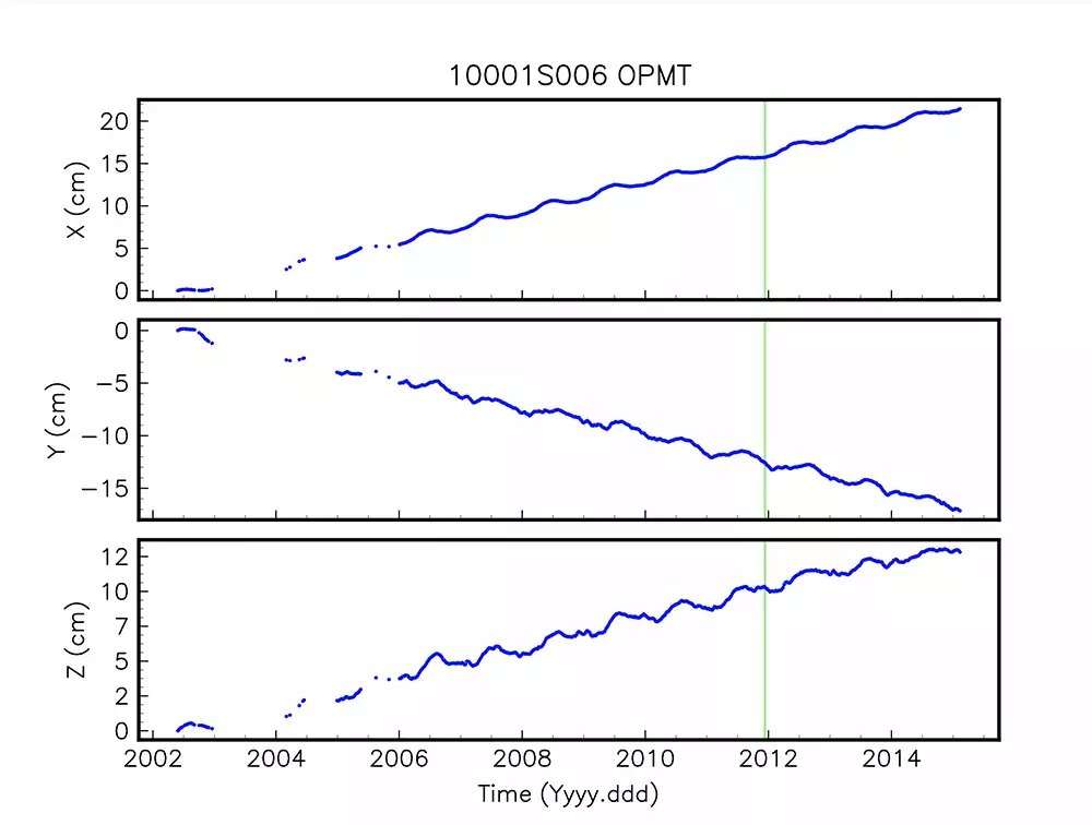
JTRF2020 Coming Soon
JTRF2020, JPL’s sequentially estimated terrestrial reference frame determined from GNSS, VLBI, SLR, and DORIS station position and EOP data spanning 1979-2020, is expected to be available Spring 2022.