Classroom Activity
Pixels on Fire
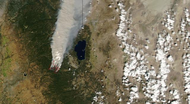
This activity is related to a Teachable Moment from Aug. 23, 2016. See "Back-to-School Burn: The Science of Wildfires."
Overview
In this activity, students use measurement and area skills to learn about remote detection of wildfires from space. After detecting mock wildfires with mobile devices, students then study satellite-data visualizations to determine the start dates of actual California wildfires.Materials
Management
- A number of pixelation apps are available for iOS and Android devices. Ideally, you should choose an app that displays a live pixelated camera view on the screen and has adjustable pixel resolution (e.g., Belowrez and Pixel Camera for iOS, and Pixel Camera for Android). Apps such as dot ART (for iOS) will suffice, though they may not provide a live through-the-lens view.
- Students should be placed in groups of two to four.
- Each group should have a mobile device, but if access to multiple devices is not possible, modifications can be made to share the device among groups.
- Because different mobile apps have different settings and functionality, it is important to download and explore the app(s) in advance to gain an understanding of how they work and how well one might best help your students complete this activity.
Background
NASA's Jet Propulsion Laboratory uses a suite of Earth satellites and airborne instruments to help better understand fires and aide in fire management and mitigation. JPL is working with a startup in San Francisco called Quadra Pi R2E to develop FireSat, a global network of satellites designed to detect wildfires and alert firefighting crews faster.
Detection of wildfires from space relies on remote sensing – observing and measuring an object without coming into contact with it. Remote sensing is accomplished by measuring the radiation being emitted by or reflected off of an object, whether it's radio waves, visible light waves or X-rays. In the case of FireSat, a system of satellites will detect wildfires by measuring infrared energy.
Energy is measured by sensors divided into an array of pixels – short for picture elements. If the computer determines that enough of a certain type of energy is hitting the pixel, it will indicate that pixel as having sensed the energy. Computers operate in binary and will only report that a pixel has detected energy or not. In the sample sensor array below, four pixels are marked as black, indicating they detected a certain type and amount of energy.
There is no "sort of" indication for a pixel, but scientists and engineers can build sensors that detect multiple levels of energy to provide more detailed information. One of these is called an 8-bit sensor and it can detect 256 different levels of energy per pixel. In the example below, four shades (black, dark grey, light grey and white) make up a 5x8 array and indicate that different amounts of a certain type of energy were detected by various pixels. Compared with the first example, this gives a more accurate reading of an area being studied.
Even with 256 different shades from black to white, the low resolution (large pixel size) makes decoding the data difficult. Smaller pixel size (higher resolution) would mean greater detail in the sensor. Reducing the pixel size and increasing the resolution to 10x16 pixels, for example, provides greater detail. In the example below, the high resolution provides a more accurate reading of where a certain type and amount of energy is coming from in the area being studied.
Resolution is important in remote sensing. If a 5x8 pixel sensor observes a 25x40-meter area, it is measuring 5 meters per pixel (25 meters/5 pixels, 40 meters/8 pixels) and each pixel is detecting 25 (5x5) square meters of surface area. A small fire covering only 10 square meters might not be detected by a satellite with this resolution because most of the area (15 square meters) represented in the pixel is neither burning nor emitting enough infrared radiation in the form of heat to trigger the sensor.
By doubling the resolution to 10x16, the sensor could detect 2.5 meters per pixel (25 meters/10 pixels, 40 meters/16 pixels) and each pixel could detect 6.25 (2.5x2.5) square meters. In this case, a 10-square-meter fire would be detected because the entire area represented in the pixel is emitting infrared radiation. (A second pixel might detect the fire as well, since the remaining 3.75 square meters of the fire is more than half of the detection area of a second pixel.)
When completed, the FireSat network of more than 200 satellites will use infrared sensors to detect fires around the world much faster than is possible today. Working 24 hours a day, the satellites will be able to automatically detect fires as small as 10 to 15 meters wide within 15 minutes of when they begin. And within three minutes of detection, the FireSat network will be able to notify emergency responders in the area.
Using these technologies, NASA scientists are gaining a broader understanding of fires and their impacts.
Procedures
- With the mobile device held level, screen up, camera down, two to three feet above the ground, use the image pixelation app to view the ground below. Identify the border of the pixelated image by sliding a piece of paper on the ground until it comes into view of the camera on one side of the screen. Use masking tape to mark that side of the border and repeat the process for all sides. You should now have a rectangle outlining the area visible in the camera. Record the height at which students are holding the device for reference in Step 7.
Note: Some image pixelation apps have the ability to increase the resolution (more pixels of a smaller size). If students are struggling to find the image-capture area, students can increase the resolution to make it easier to identify the edge of the image. - Use a ruler or a meter stick to measure the length of the sides identified and calculate the area of the rectangle visible in the camera. As long as the mobile device is held at the same height above the ground, this area will remain constant. After the area has been calculated, remove the tape from the ground. (Students will be walking with their devices and shouldn't be bound to the original location.)
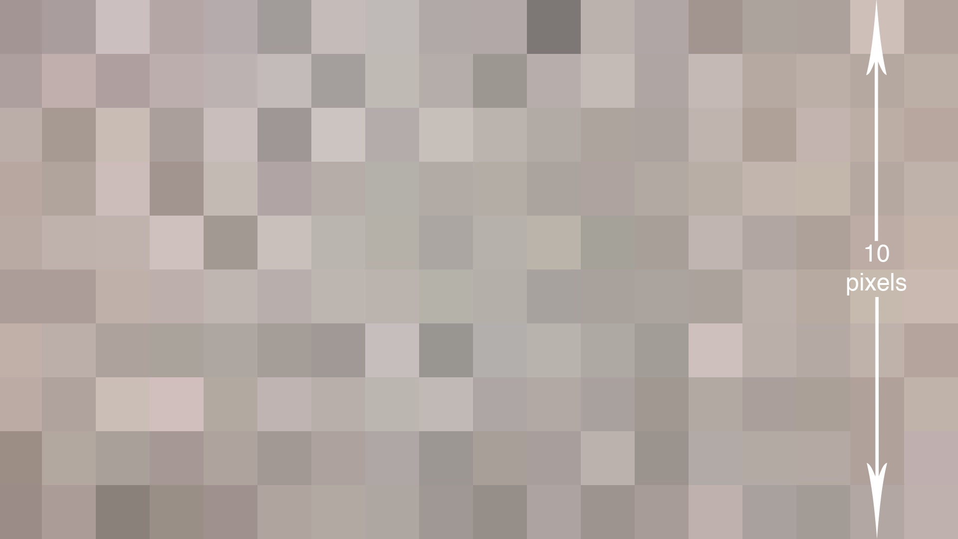
- Adjust the resolution so that the pixels are not too big or too small. A good size for this activity will give you approximately 10 pixels along the short edge of the screen.

- Divide the length of one side of the area captured by the number of pixels along that side. This gives students the resolution of their measurement device. For example, if one side of the rectangle is 42 cm long and there are 10 pixels along that side of the image, 42 cm/10 pixels reveals that the image shows 4.2 centimeters per pixel.
- Have students cut paper into different two-dimensional shapes (triangles, rectangles, etc.) of differing sizes (e.g., squares 2 cm, 4 cm, and 6 cm to a side; and triangles 3 cm, 5 cm and 6 cm on the longest side). These shapes represent mock wildfires that students will try to detect.
- Spread the shapes out in a straight path along the floor. Separate them enough so that no more than two mock fires appear in an image at once.
- With the mobile device at the same height as it was when the image-capture area was found, slowly move over the shapes. When a pixel or multiple pixels change to indicate a fire below, capture the image (either through the app or a screen capture) and make note of the name and size of the shape, as well as the number of pixels that detect the shape. If a shape is not detected, make note of the name and size of the shape. Continue this process for each fire.
- If all the fires were detected, repeat Step 7, holding the mobile device higher above the ground until at least one fire is not detected. Then repeat Steps 1 through 4 to determine the resolution at which not all fires were detected. If not all fires were detected at the original height, repeat Step 7 holding the mobile device closer to the ground until all fires are detected. Then repeat Steps 1 through 4 to determine the resolution at which all fires were detected.
Note: the size of each shape, room lightning, color and contrast of paper, choice of mobile app, settings within the app and type of mobile device can all impact the detection of mock fires.
- Explain to students that as they “fly over” the simulated fires, looking down with their camera app, they are doing exactly what a NASA satellite does when it remotely observes Earth phenomena.
Students can complete the following steps immediately after Steps 1 through 9 or later, as time allows:
- From a desktop or laptop computer, launch NASA's Eyes program and select Eyes on the Earth. If it is not installed, visit Eyes on the Earth and download the app.
Note: Earth Now, a mobile app version of the program, allows students to view carbon monoxide data visualizations, but the data sets available to view are limited and won't allow students to answer the questions in Step 4. - Move the speed slider at the bottom of the screen all the way to the left to hold Earth's position still. Then click and drag Earth to position North America in the middle of the screen.
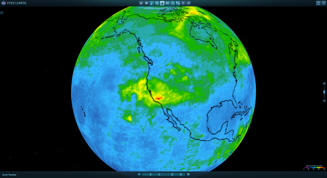
- From the Vital Signs of the Planet section at the top, select Carbon Monoxide. The map displayed shows a three-day average of carbon monoxide (CO) levels detected at 18,000 feet by the Atmospheric Infrared Sounder (AIRS) instrument on the Aqua satellite. When wildfires burn, they release large amounts of carbon dioxide and carbon monoxide. Remote sensing of high concentrations of these gases, especially CO, can indicate fires on Earth's surface.
- In the carbon monoxide window on the left, click "choose dates" and select 5/28/13 as a start date and 6/28/13 as an end date. Then click "Submit Dates."
During this time period the Powerhouse Fire in Los Angeles began. Ask students to identify the date the Powerhouse Fire began (May 30, 2013), based on increased CO levels in the region. To aid in accuracy, students can zoom in as well as click the frame-by-frame navigation buttons in the playback window.
Repeat this process for the following fires:
- Rim Fire (began August 17, 2013 in Northern California)
Date range selection: 8/10/13 to 9/10/13 - July Complex Fire (began August 3, 2014 in Northern California)
Date range selection: 7/24/14 to 8/24/14
Note: Because the data are three-day averages of CO levels, student answers may be off by a day or two and still be considered accurate. Have students create a screen capture and identify (either by editing the image file or printing it and writing on it) the CO plume that indicates the fire. - Rim Fire (began August 17, 2013 in Northern California)
- Click and drag Earth to explore areas of high concentrations of CO. Select dates to see how the concentrations might change over a time period of up to two months, and during different times of year (e.g., fall, winter, spring and summer). Consider the source(s) of these high concentrations of CO and why they might be changing over time.
Discussion
- Did the shape of a mock fire influence whether or not it was detected? If so, which shape was the easiest to detect? Which was most difficult?
- How did the height of the sensor (mobile device) affect its ability to detect mock fires?
- How would changing the resolution affect your ability to detect mock fires?
- Where on Earth do you see large concentrations of CO?
- Why do you think there are areas of high CO concentration in those areas? Does it stay in those areas?
Assessment
Students should complete the activity data sheet.
Extensions
- View the Facebook Live event featuring JPL wildfire expert Natasha Stavros
- In NASA's Eyes on the Earth, click the event timeline to view the CO output associated with different events.
- Learn about FireSat in this JPL press release.
- SciJinks: Can Meteorologists Help Fight Wildfires?
- Commercially available infrared cameras are available that can be connected to iOS and Android devices. Using coins of different sizes heated in warm water, repeat the steps of the fire-detection process using the coins in place of the cut-out shapes.


